First Alert Forecast l Heat advisory Saturday, stray late day storm possible
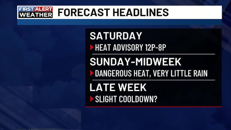
A Heat Advisory is in effect Saturday for most of the CSRA. Dangerous heat with slim rain chances for the next few days.
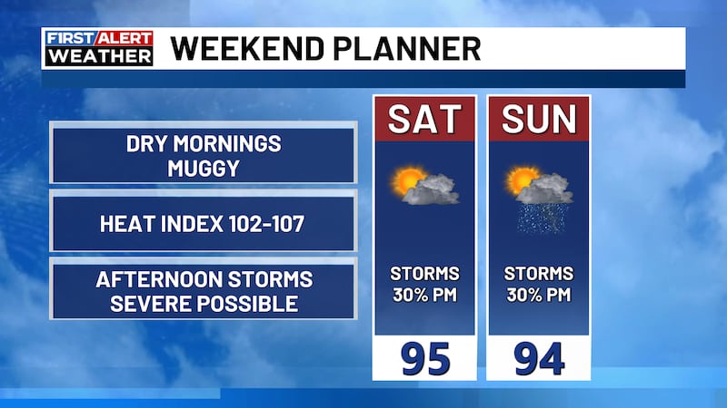
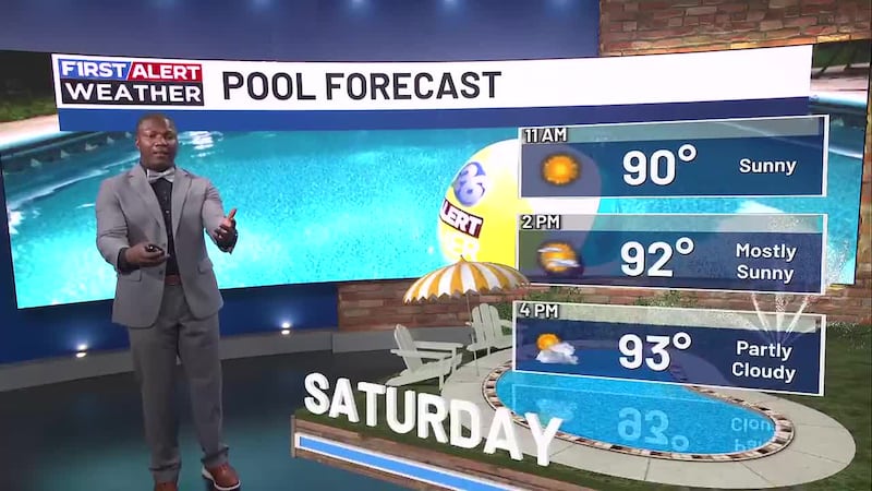
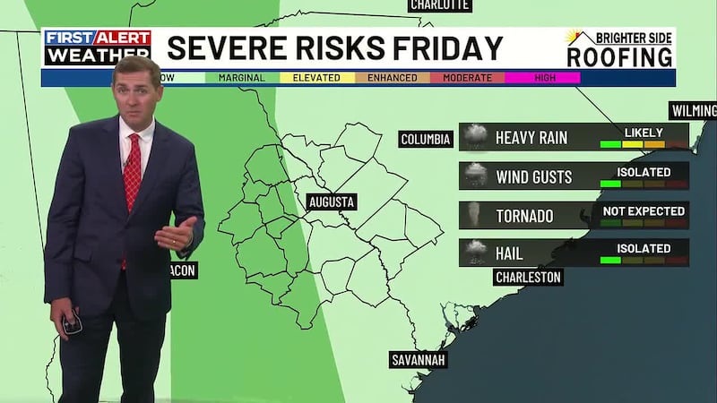
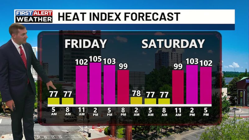
AUGUSTA, GA — (WRDW/WAGT) Dangerous heat with high humidity will be an ongoing theme this weekend through midweek. A heat advisory that includes most of the CSRA will be in effect from Noon through 8PM Saturday with feels like temperatures that could reach 108 degrees Saturday afternoon. A few “splash ‘n’ dash” storms are possible in a few spots, but most of us will not get rain Saturday. There will be plenty of instability in the atmosphere, so any storms that do manage to form could be strong to even severe with gusty winds or small hail possible.
Very little change is expected Sunday, Monday or Tuesday, but a cold front will approach Georgia-Carolina Wednesday into Thursday that could provide a slightly better chance of storms Wednesday and Thursday and a slight cooldown by Thursday into Friday.
Saturday - Partly sunny, hot and very humid with a 20 percent chance of thunderstorms after 2 p.m. Highs in the middle 90s. Feels like/heat index temperatures 105 to 108. Wind from the southwest 5 to 10 mph.
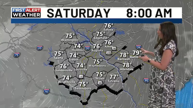
Saturday Night - Partly cloudy with a 30 percent chance of storms before 10 p.m. Lows in the middle 70s. Wind from the southwest 3 to 6 mph.
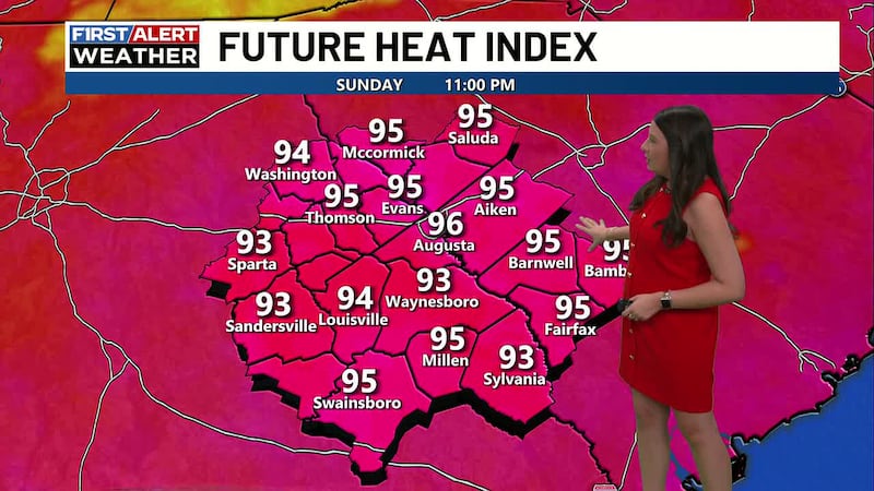
Sunday - Partly sunny with a 20% chance of afternoon thunderstorms. High in the middle 90s. Heat index/feels like temperatures 104-106.
Monday and Tuesday - Partly sunny, seasonably hot and humid each day through Wednesday with a 20 percent chance of a brief shower or thunderstorm. Highs in the middle to upper 90s Monday dropping to near average in the middle 90s Tuesday and Wednesday.
Wednesday - A cool front approaches late Wednesday boosting storm chances to 30 percent. Highs will remain seasonably hot in the middle 90s.
Thursday/Friday - A cool front will be in the area late week that could boost storm chances a bit Thursday. If the front passes through the CSRA, we could get a bit of a break from the heat and humidity Friday into next weekend with highs falling back into the lower 90s and overnight lows around 70 degrees - only a slight break, but we will take all we can get!
Copyright 2026 WRDW/WAGT. All rights reserved.